IN YOUR CART
7 Things I learnt When I Shipped A GPS Tracker Across America
One of the things that gets my new customers excited — especially the ones who have never seen GPS tracking for real as opposed to seeing it in a James Bond movie — is when I tell them they will be able to follow it being delivered to them in realtime.
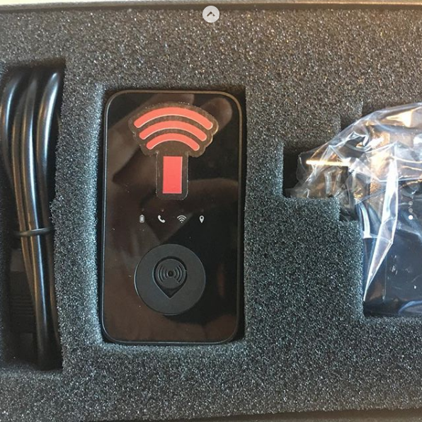
Last week, I shipped out one of our TrackinaPack:AdvancedPlus units by Fedex Ground which was going to go from Encinitas on the west coast of the USA to a customer in New Rochelle, New York on the east coast. I decided to keep a track of its progress myself and here are 7 things I learnt.
1. How Far Did The Package Travel?
Total distance 2,717.67 miles

2. How Long Did It Take?
Journey time, door to door: 5 days, 21 hours, 31 minutes
3. How Many States Did The Package Travel Through?
12 states, in order of travel: California, Arizona, New Mexico, Texas, Oklahoma, Missouri, Illinois, Indiana, Ohio, Pennsylvania, New Jersey, New York
4. Which Route Did The Package Take?
Major freeways used:
Encinitas, CA > to Oceanside, CA Interstate 5
Oceanside, CA > San Bernadino, CA Interstate 215
San Bernadino, CA > Barstow, CA Interstate 15
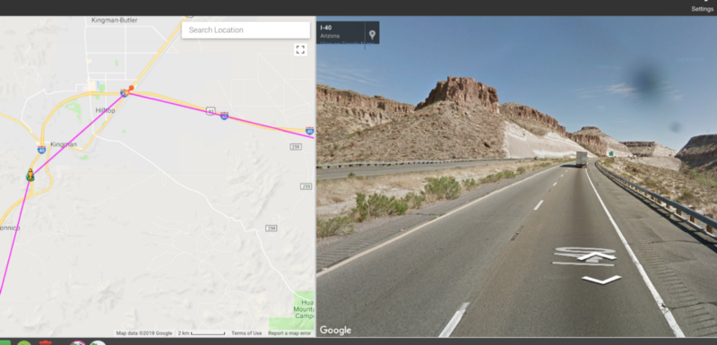
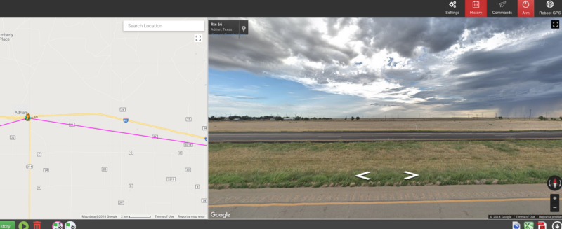
Barstow, CA > Oklahoma City, OK Interstate 40
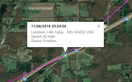
Oklahoma, OK > St Louis, MO Interstate 44
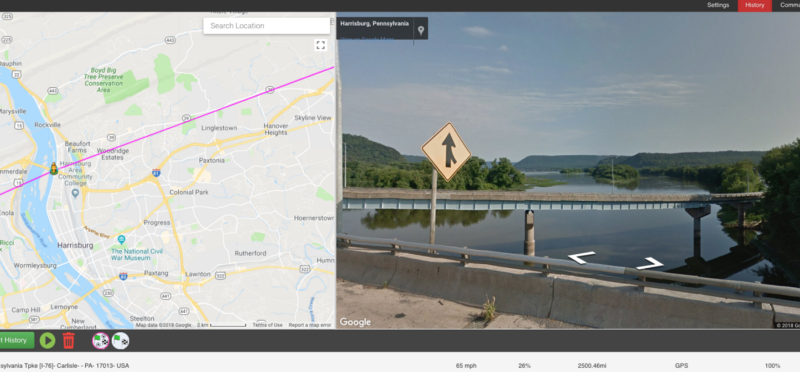
St Louis, MO > Breezewood, PA Interstates 270, 255 70, 76 Turnpike
Breezewood, PA > Carlisle, PA Interstate 76
Carlisle, PA > Edison, NJ Interstate 76, 81, 78, 287
5. Time and Speed Data
Shortest time in a state:
Texas — 2 hours, 46 minutes, 11 seconds
Longest time in a state:
New York — 2 days, 12 hours 23 minutes 50 seconds
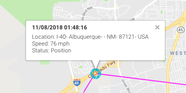
Top speed:
76 mph 8 November 2018 01.48 am I40 New Mexico
6. Curious Facts From Looking At The Maps
Town passed by on route that i thought was a name that only existed in Roadrunner — Acme, Pennsylvania, driven past at 09.31 am at 22mph on 9th November
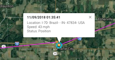
Towns passed through that share their name with a country:
Cuba, Missouri and Brazil, Indiana
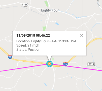
Town passed which is called a number: Eighty Four, Pennsylvania
7. There Were Some Pretty Views
I didn’t really have time to trawl through every streetview image for each GPS co-ordinate — there is 674 of them, but here are a couple of images I did see: